Design
asd
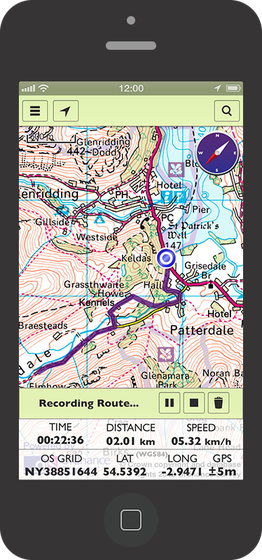
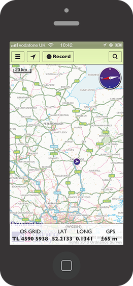
Ordnance Survey is a public body who have been producing amazingly detailed maps of Great Britain since 1791, and they continue to provide the most accurate and complete mapping data available. They initially asked Airsource to develop an SDK (Software Development Kit) for iOS which would be easy for developers to use, but which would still support all the features needed for a consumer app. Through further research and development discussions with OS we resolved to closely follow the interface of Apple's MapKit framework. This would reduce the learning curve for future developers incorporating the SDK in their apps, increasing the adoption potentiality.
Ordnance Survey is a large organisation, and its production techniques have historically been geared to print, so the available map scales did not fit the typical power-of-two zoom pattern. Nor did they match the WGS84 grid widely used by other web map providers and SDKs. In addition, the SDK needed to support offline operation with partial fill at different map scales, with smooth fallback rules in the event of missing tiles.
asd
Airsource proposed a desirable interface based on Apple MapKit, built the SDK, and provided developer support throughout the development of their first iOS application. Following on from the success of the initial iOS project, the Ordnance Survey also commissioned Airsource to develop an Android version of the SDK. We also supported ongoing development of their first Android consumer app.
Created in-house by Airsource Limited. © 2003-2024 Airsource Limited. All rights reserved.


